Hiker Public Profile
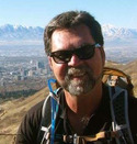
Steve Baker
If you are in the Salt Lake City area and want to hike our beautiful Wasatch Mountains. Join us on a hike or snowshoe. We meet on Sundays and have a great time together. View each Sundays hike at: http://www.visualpossibilities.com/hike/
Hiker Steve
Hiker Steve
Organizer for These Hiking Groups
- Visual Possibilities Hiking Group
- Group description: Private hiking group in the Salt Lake City area. If you find yourself in Salt Lake and want to go hiking, do join us on a Sunday. This is a very social group and we always take our time hiking through the beautiful Wasatch Mountains. Email me with questions: visualpossibilities@gmail.com See last weeks adventure at: http://www.visualpossibilities.com/hike/ Hiker Steve
Member of These Hiking Groups
- Bank Holiday Land's End Hiking
- Group description: This group is for hikers who get Holidays off from work, such as Veterans Day, Columbus Day, Labor Day, etc. and want to spend the morning on a stroll in scenic Land's End! We meet on Bank Holidays at 10:15 on the North West Corner of 27th Avenue and California. Reminders will be posted on the hiking event calendar.
- Michigan Hikers
- Group description: A group for hikers in the great state of Michigan, focusing primarily on hikes in the northwestern lower peninsula. Come hike with us at Ludington State Park, Sleeping Bear Dunes, the North Country Trail, and many other scenic Michigan venues.
Hikes attended by SteveBaker
- This member did not attend any hikes.
Hikes Led by SteveBaker
- Birch Springs Trail in Utah
- Hike description: VP hikers, Sorry for the very late notice. With Saturday being the better day this weekend, we are going tomorrow. None of us have snowshoed this trail before, so we will hope the trail is broken. View the PDF of this snowshoe. Even I'm going this week as I'm back to normal! DOGS: This snowshoe is on the border of the watershed. I would think dogs would be ok, you decide. You will need to drive you and your hairy friend to the trailhead. WEATHER ISSUES: If we need to cancel the hike because of bad weather, I will send out an email by 9:30 am Saturday morning. So check your email before you leave. DIFFICULTY: Easy/Moderate ELEVATION GAIN: Unsure, but looks like the trail stays on the ridgeline, heading up and down to Birch Springs. ROUND TRIP MILES: About 5 miles\ LUNCH WITH A VIEW: Don't forget to bring a lunch and water. MEETING and LEAVING AT 10:00 A.M. (come 15 minutes early to socialize) We will be meeting at the old K-Mart on Parleys Way and Foothil...
- North Canyon Snowshoe in Utah
- Hike description: Conley and Steve will be your leaders on a North Canyon snowshoe. North Canyon is located in North Salt Lake. See my "Hike of the Week" about this snowshoe: http://www.sltrib.com/csp/cms/sites/sltrib/Outdoors/hikes.csp?hike=355 DOGS: Are allowed, but you will need to drive you and your hairy friend to the trailhead. Please bring a leash too. WEATHER ISSUES: If I need to cancel the snowshoe because of bad weather, I will send out an email by 9 AM Saturday morning. So check your email before you go. DIFFICULTY: Moderate ELEVATION GAIN: About 1,200 feet ROUND TRIP MILES: About 5 miles LUNCH WITH A VIEW: Don't forget to bring a lunch, sunscreen and water. MEETING and LEAVING AT 10 A.M. (come 15 minutes early to socialize) We will be meeting at Sam's Club on 1850 South 300 West. Meet us on the southwest corner of the parking lot. MEETING OPTION II: If you live in Davis County you can meet us at the trailhead. From Orchard Drive, turn onto North Canyon Road. When...
- Bell Canyon Waterfall in Utah
- Hike description: Bruce will be your leaders on a Bells Canyon snowshoe to the lower waterfall. Read "Hike of the Week" about this trail: http://extras.sltrib.com/hikes/detail.asp?id=126 DOGS: Sorry, dogs are NOT allowed, WEATHER ISSUES: If Bruce needs to cancel the hike because of bad weather, I will send out an email for him by 9 AM Sunday morning. So check your email before you go. DIFFICULTY: Moderate ELEVATION GAIN: About 1,200 feet ROUND TRIP MILES: About 5 miles LUNCH WITH A VIEW: Don't forget to bring a lunch, sunscreen and water. MEETING and LEAVING AT 10 A.M. (come 15 minutes early to socialize) Meeting at the South Town Mall in Sandy, in the REI parking lot. Meet on the south end of the parking lot. DRIVERS: If we have a large number of hikers, please consider being one of the drivers. From the parking lot, we will carpool. Please help your drive with the gas expense. YOUR HIKING LEADER: Bruce: 801-573-8443
- Uinta wilderness snowshoe in Utah
- Hike description: VP hikers, We are snowshoeing in the Uintas this Sunday. Lets decide which trail to do from the K-Mart parking lot. If you have maps of the area, please bring them. Plan on a longer day because of the drive time. DOGS: Allowed on this hike, but you will need to drive you and your hairy friend to the trailhead. WEATHER ISSUES: If we need to cancel the snowshoe because of bad weather, I will send out an email by 7:30 am Sunday morning. So check your email before you leave. DIFFICULTY: Easy/Moderate ELEVATION GAIN: Unsure, but most trails have little elevation. ROUND TRIP MILES: No more then 5 miles. LUNCH WITH A VIEW: Don't forget to bring a lunch and water./ DAY USE FEE: There is a fee on the Mirror Lake Highway. It will cost you $6. If you have a pass please bring. MEETING and LEAVING AT 8:30 A.M. (come 15 minutes early to socialize)We will be meeting at the old K-Mart on Parleys Way and Foothill Blvd, (about 2100 South). Meet us on the southeast side of ...
- Snowshoeing to Stewart Falls in Utah
- Hike description: VP hikers, This Sunday Bruce and Conley will be leading the snowshoe to Stewart Falls. The falls is located in Provo Canyon and starts at Sundance. WEATHER ISSUES: If we need to cancel the hike due to the weather. I will email you by 8:00 AM Sunday, so check your mail before you leave for the parking area. DOGS: Dogs are allowed on this snowshoe, but you will have to drive your hairy friend to the trailhead. Please bring a leash. LENGTH: About 5 miles DIFFICULTY: Moderate ELEVATION GAIN: Unsure LUNCH WITH A VIEW: Don't forget to bring one. MEETING TIME: We will leave the parking lot at 9:00 AM. Come 15 minutes early to socialize. FIRST MEETING PLACE: Meeting at 7200 South and I-15 freeway. If you are heading south on I-15, take the 7200 South Exit. At the light turn left (east), make a quick right onto the Frontage Road. The Frontage Road is between 1-15 and McDonald's. From 7200 South, we get on I-15, drive south and make a stop at 12300 South to meet up...
- Dry Creek Canyon Snowshoe in Utah
- Hike description: VP hikers, This Sunday Bruce, Conley and Steve will be leading the snowshoe up Dry Creek. Dry Creek is located at Alpine, Utah in Happy Valley. WEATHER ISSUES: If we need to cancel the snowshoe due to the weather. I will email you by 8:00 AM Sunday, so check your mail before you leave for the parking area. DOGS: Dogs are allowed on this snowshoe, but you will have to drive your hairy friend to the trailhead. Please bring a leash. LENGTH: About 4-5 miles DIFFICULTY: Moderate ELEVATION GAIN: Unsure LUNCH WITH A VIEW: Don't forget to bring one. MEETING TIME: We will leave the parking lot at 9:00 AM. Come 15 minutes early to socialize. FIRST MEETING PLACE: Meeting at 7200 South and I-15 freeway. If you are heading south on I-15, take the 7200 South Exit. At the light turn left (east), make a quick right onto the Frontage Road. The Frontage Road is between 1-15 and McDonald's. From 7200 South, we get on I-15, drive south and make a stop at 12300 South to meet ...
- Stansbury Island hike in Utah
- Hike description: VP hikers, This Saturday Steve and Conley are leading you on a loop hike on Stansbury Island. We will be viewing the pictographs and enjoy beautiful views of the Great Salt Lake. Plan on a longer day because of the drive time. The weather man says, look for sunny skies with a high of 45 degrees. I might just have to wear shorts on this one! DOGS: Are allowed, but you will need to drive you and your hairy friend to the trailhead. WEATHER ISSUES: If I need to cancel the hike because of bad weather, I will send out an email by 8 AM Saturday morning. So check your email before you go. DIFFICULTY: Easy/Moderate ELEVATION GAIN: About 900 feet ROUND TRIP MILES: About 5 miles LUNCH WITH A VIEW: Don't forget to bring a lunch, sunscreen and water. MEETING and LEAVING AT 9 A.M. (come 15 minutes early to socialize) We will be meeting at Sam's Club on 1850 South 300 West. Meet us on the southeast corner of the parking lot. MEETING OPTION II: If you live in Tooele C...
- Snowshoe in Utah
- Hike description: VP hikers, The weather on Sunday is iffy, to say the least. With that said, our best decision is to meet at 6200 South and decide from there. DOGS: Lets leave the dogs home, giving us more choices for snowshoeing. WEATHER ISSUES: If we need to cancel the snowshoe because of bad weather, I will send out an email by 8:00 AM Sunday morning. So check your email before you go. DIFFICULTY: Unsure ELEVATION GAIN: Unsure ROUND TRIP MILES: 4-5 miles LUNCH WITH A VIEW: Don't forget to bring a lunch, sunscreen and water. MEETING and LEAVING AT 9:00 A.M. (come 15 minutes early to socialize) We are meeting at the 6200 South Park-n-Ride, off Wasatch Blvd. This is NOT the parking lot at the mouth of Big Cottonwood Canyon. It's the one just north of the sand pit. DRIVERS: If we have a large number of hikers, please consider being one of the drivers. From the parking lot, we will carpool. Please help your drive with the gas expense. YOUR HIKING LEADER: Conley: 8...
- Snowshoe in Utah
- Hike description: VP hikers, The weather on Sunday is iffy, to say the least. With that said, our best decision is to meet at 6200 South and decide from there. DOGS: Lets leave the dogs home, giving us more choices for snowshoeing. WEATHER ISSUES: If we need to cancel the snowshoe because of bad weather, I will send out an email by 8:00 AM Sunday morning. So check your email before you go. DIFFICULTY: Unsure ELEVATION GAIN: Unsure ROUND TRIP MILES: 4-5 miles LUNCH WITH A VIEW: Don't forget to bring a lunch, sunscreen and water. MEETING and LEAVING AT 9:00 A.M. (come 15 minutes early to socialize) We are meeting at the 6200 South Park-n-Ride, off Wasatch Blvd. This is NOT the parking lot at the mouth of Big Cottonwood Canyon. It's the one just north of the sand pit. DRIVERS: If we have a large number of hikers, please consider being one of the drivers. From the parking lot, we will carpool. Please help your drive with the gas expense. YOUR HIKING LEADER: Conley...
- Miners Trail snowshoe in Utah
- Hike description: VP hikers, Sorry for the very late notice. We are snowshoeing the Miners Trail up Emigration Canyon. The trailhead parking area has limited space. Lets pack the cars and carpool together. If we find there is no parking, we will choose another trail in Emigration or East Canyon. Here is a link about the Miners Trail: http://www.sltrib.com/csp/cms/sites/sltrib/Outdoors/hikes.csp?hike=414 DOGS: Dogs are allowed on this snowshoe, but you need to drive you and your hairy friend to the trailhead. WEATHER ISSUES: If we need to cancel the snowshoe because of bad weather, I will send out an email by 8:30 am Sunday morning. So check your email before you leave. DIFFICULTY: Moderate ELEVATION GAIN: 1,150 feet ROUND TRIP MILES: 4.8 miles LUNCH WITH A VIEW OVERLOOKING RED BUTTE CANYON: Don't forget to bring a lunch and water. MEETING and LEAVING AT 9:30 A.M. (come 15 minutes early to socialize) We will be meeting at the old K-Mart on Parleys Way and Foothill B...
- Uinta wilderness snowshoe in Utah
- Hike description: VP hikers,
We didn't make the Uintas last Sunday, so lets do it this Sunday. We will decide which trail to snowshoe from the K-Mart parking lot. Plan on a longer day because of the drive time.
DAYLIGHT SAVINGS: We loose an hour of sleep Saturday night. Make sure to set your clocks ahead before bedtime, so your on time Sunday morning.
DOGS: Are allowed, but you will need to drive you and your hairy friend to the trailhead.
WEATHER ISSUES: If we need to cancel the hike because of bad weather,
I will send out an email by 8:00 am Sunday morning. So check your
email before you leave.
DIFFICULTY: Should be a moderate snowshoe
ELEVATION GAIN: Unsure
ROUND TRIP MILES: Unsure
LUNCH WITH A VIEW: Don't forget to bring a lunch and water.
MEETING and LEAVING AT 9:00 A.M. (come 15 minutes early to socialize)
We will be meeting at the old K-Mart on Parleys Way a... - Desolation Lake snowshoe in Utah
- Hike description: VP hikers, We are snowshoeing to Desolation Lake in Big Cottonwood Canyon. First day of Spring!!!!!!! DOGS: Sorry, NO dogs allowed. WEATHER ISSUES: If we need to cancel the snowshoe because of bad weather, I will send out an email by 8:30 AM Sunday morning. So check your email before you go. YOUR HIKING LEADER: Conley: 801-232-3452 Bruce: 801-573-8443 Steve: 801-631-4222
- Mormon Pioneer Trail - snowshoe in Utah
- Hike description: VP hikers, Once again the weather is looking unpredictable for Sunday. We will try to snowshoe the Mormon Pioneer Trail in East Canyon. View attached PDF for this snowshoe. WEATHER ISSUES: If we decide to cancel the snowshoe, I'll send out a notice by 8:30 Sunday morning. So check your messages before you head to the parking area. DOGS: Sorry, dogs are NOT Allowed. DIFFICULTY: Easy ELEVATION GAIN: About 500 feet. ROUND TRIP MILES: About 4.5 miles LUNCH WITH A VIEW: Don't forget to bring a lunch and water. MEETING and LEAVING AT 9:30 A.M. (come 15 minutes early to socialize) We will be meeting at the old K-Mart on Parleys Way and Foothill Blvd, (about 2100 South). Meet us on the southeast side of the parking lot. DRIVERS: If we have a large number of hikers, please consider being one of the drivers. From the parking lot, we will carpool. Please help your drive with the gas expense. YOUR HIKING LEADERS: Conley: 801-232-3452 Bruce: 801-573-8443 Steve:...
- Stansbury Island rock scramble in Utah
- Hike description: VP hikers, Sorry for the very late notice. The weather is going to be beautiful on Saturday and we are hiking on Stansbury Island. This will be a rock scramble up and take a easier way down. Plan on a longer day because of the drive time. DOGS: Are allowed, but you will need to drive you and your hairy friend to the trailhead. There is no water on the island for your dog. WEATHER ISSUES: No issues, will be nice weather for shorts. DIFFICULTY: Moderate ELEVATION GAIN: Unsure ROUND TRIP MILES: About 5 miles LUNCH WITH A VIEW: Don't forget to bring a lunch, sunscreen and water. MEETING and LEAVING AT 9 A.M. (come 15 minutes early to socialize) We will be meeting at Sam's Club on 1850 South 300 West. Meet us on the southeast corner of the parking lot. MEETING OPTION II: If you live in Tooele County you can meet us at the second Grantsville Exit off I-80. The group should be there at 9:45 AM. Please call Conley or me Saturday morning letting us know this is y...
- Stansbury Island westside hike in Utah
- Hike description: VP hikers, I'm ready for Spring, but the weather continues being wet and cold. (I want Spring to be 75 degrees and sunny, is that asking too much?) The VP Group is finished snowshoeing for the season and will be hiking from now on. With that said, we are going back to Stansbury Island and hiking on the bicycle trail. It's really the only place to hike out of mud and snow this weekend. Expect wet conditions and bring rain gear. DOGS: Are allowed, but you will need to drive you and your hairy friend to the trailhead. There is no water on the island for your dog. WEATHER ISSUES: If we need to cancel the hike because of rain, I will send out an email by 8:00 AM Sunday morning. So check your email before you go to the meeting place. DIFFICULTY: Easy/Moderate ELEVATION GAIN: Unsure ROUND TRIP MILES: About 5 miles LUNCH WITH A VIEW: Don't forget to bring a lunch, sunscreen and water. MEETING and LEAVING AT 9 A.M. (come 15 minutes early to socialize) We will be meet...
- Window Rock Trail in Utah
- Hike description: VP hikers, This Sunday Bruce is leading you up to Window Rock, in the Corner Canyon area above Draper. There will be some light bush whacking for 1 mile and possible mudd/snow on the trail. WEATHER ISSUES: If we need to cancel the hike due to the weather. I will email you by 8:30 AM Sunday, so check your mail before you leave for the parking area. DOGS: Sorry, NO Dogs allowed. LENGTH: About 7 miles DIFFICULTY: Moderate ELEVATION GAIN: About 1,500 feet LUNCH WITH A VIEW: Don't forget to bring one. MEETING TIME: We will leave the parking lot at 9:30 AM (7200 South meeting area). Come 15 minutes early to socialize. FIRST MEETING PLACE: Meeting at 7200 South and I-15 freeway. If you are heading south on I-15, take the 7200 South Exit. At the light turn left (east), make a quick right onto the Frontage Road. The Frontage Road is between 1-15 and McDonald's. From 7200 South, we get on I-15, drive south and meet up with the rest at Billard Equestrian Center in Drap...
- Grove Creek Trail in Utah
- Hike description: VP hikers,\r\n\r\nJoin us Easter Sunday on the trail. We are hiking to Grove Creek Waterfall, above Pleasant Grove. This trail should be clear of mud and snow. The waterfall should be spectacular with the runoff and we might even see the Easter Bunny! View attached PDF about this hike.\r\n\r\nDOGS: Are allowed, but you will need to drive you and your hairy friend to the trailhead. \r\n\r\nWEATHER ISSUES: If we need to cancel the hike because of rain, I will send out an email by 8:30 AM Sunday morning. So check your email before you go to the meeting place.\r\n\r\nDIFFICULTY: Moderate\r\n\r\nELEVATION GAIN: 1,520 ft.\r\n\r\nROUND TRIP MILES: About 4.25 miles\r\n\r\nLUNCH OVERLOOKING THE WATERFALL: Don\'t forget to bring a lunch, sunscreen, water and a Easter treat.\r\n\r\nMEETING TIME: We will leave the parking lot at 9:30 AM. Come 15 minutes early to socialize.\r\n\r\nMEETING PLACE: Meeting at 7200 South and I-15 freeway. If you are heading south on I-15, take the 7200 South Exit. A...
- Sunset Trail in Utah
- Hike description: VP hikers, As most of you know my schedule has changed and I need to be more flexible on hiking days. This week we are hiking on Monday and going to Farmington Canyon. The trail takes you past a small waterfall, as we make our way to the campground for lunch. View the PDF, "Hike of the Week" about this trail. DOGS: ARE ALLOWED - You will need to drive you and your hairy friend to the trailhead. WEATHER ISSUES: If we need to cancel the hike because of bad weather, I will send out an email by 8:00 AM Monday morning. So check your email before you go. DIFFICULTY: Not too difficult ELEVATION GAIN: 1,175 feet ROUND TRIP MILES: 3.8 miles LUNCH WITH A VIEW: Don't forget to bring a lunch, sunscreen and water. MEETING and LEAVING AT 9 A.M. (come 15 minutes early to socialize) We will be meeting at Sam's Club on 1850 South 300 West. Meet us on the southeast corner of the parking lot. MEETING OPTION II: If you live in Davis County you can meet us at the mouth...
- Sentry Peak - Antelope Island, Great Salt Lake in Utah
- Hike description: VP hikers, This Mother's Day we are going to Antelope Island and hiking Sentry Peak. We start the hike at Garr Fielding Ranch, where we pick up our hiking permit. Read my "Hike of the Week" about this trail. DOGS: Are NOT allowed. WEATHER ISSUES: If we need to cancel the hike because of bad weather, I will send out an email by 8:00 AM Sunday morning. So check your email before you go. DIFFICULTY: Moderate ELEVATION GAIN: 1,114 feet ROUND TRIP MILES: 7 miles LUNCH WITH A VIEW: Don't forget to bring a lunch, sunscreen and lots of water. MEETING and LEAVING AT 9 A.M. (come 15 minutes early to socialize) We will be meeting at Sam's Club on 1850 South 300 West. Meet us on the southeast corner of the parking lot. MEETING OPTION II: If you live in Davis or Wasatch Counties you can meet us at the island causeway. At the causeway, park at the restroom before the toll booth and the group should arrive there at 9:45 AM. Please call me Sunday morning if this is ...
- Squaw Peak hike in Utah
- Hike description: VP hikers, I have this Sunday off and will be on the trail with you. We are joining the Wasatch Mountain Club to Squaw Peak, in Utah County. Liz Cordova is the club leader of the hike. Plan on a longer day because of the drive time. DOGS: ARE ALLOWED - You will need to drive you and your hairy friend to the trailhead. WEATHER ISSUES: If we need to cancel the hike because of bad weather, I will send out an email by 8:00 AM Sunday morning. So check your email before you go. DIFFICULTY: Moderate ELEVATION GAIN: About 2,000 feet ROUND TRIP MILES: About 8 miles LUNCH ON THE PEAK: Don't forget to bring a lunch, sunscreen and water. MEETING and LEAVING AT 9 A.M. (come 15 minutes early to socialize) We will be meeting at the REI parking lot on 10600 South. Meet us on the south end of the parking lot. DRIVERS: If we have a large number of hikers, please consider being one of the drivers. From the parking lot, we will carpool. Please help your drive with the...
- Stewart Falls
- Hike description: VP hikers, This Sunday Bruce and Conley will be leading a one-way hike from Aspen Grove to Sundance area. Hiking is downhill and you will pass by Steward Falls. I will not be on the hike because I'm working Sunday. DOGS: Call Bruce to see if he is allowing dogs. LENGTH: Unsure DIFFICULTY: Moderate ELEVATION GAIN: Unsure LUNCH WITH A VIEW: Don't forget to bring one. MEETING TIME: We will leave the parking lot at 9:00 AM. Come 15 minutes early to socialize. FIRST MEETING PLACE: Meeting at 7200 South and I-15 freeway. If you are heading south on I-15, take the 7200 South Exit. At the light turn left (east), make a quick right onto the Frontage Road. The Frontage Road is between 1-15 and McDonald's. From 7200 South, we get on I-15, drive south and make a stop at 12300 South to meet up with Bruce's group. After regrouping, we all drive to Happy Valley together. SECOND MEETING PLACE II: If you live in the Draper area, meet Bruce at the 7-11 on 12300 South. Exit on...
- Tibble Fork Loop in Utah
- Hike description: VP hikers, This Sunday Bruce and Conley will be leading a loop hike at Tibble Fork, in American Fork Canyon. I'm not going on Sunday, but if someone is interested hiking with me on Monday, email and we will make a plan. DOGS: Call Bruce and talk to him about this. LENGTH: Unsure DIFFICULTY: You can do it! ELEVATION GAIN: Unsure LUNCH WITH A VIEW: Don't forget to bring one and bug spray. MEETING TIME: We will leave the parking lot at 9:00 AM. Come 15 minutes early to socialize. FIRST MEETING PLACE: Meeting at 7200 South and I-15 freeway. If you are heading south on I-15, take the 7200 South Exit. At the light turn left (east), make a quick right onto the Frontage Road. The Frontage Road is between 1-15 and McDonald's. From 7200 South, we get on I-15, drive south and make a stop at 12300 South to meet up with Bruce's group. After regrouping, we all drive to the trailhead. SECOND MEETING PLACE II: If you live in the Draper area, meet Bruce at the 7-11 on 1230...
- Scout Falls in Utah
- Hike description: VP hikers, This Sunday Bruce and Conley will be leading a hike to Scout Falls along the Timpanokee Trail, American Fork Canyon. I won't be on this hike due to my work schedule :( DOGS: Call Bruce it see what he thinks about bring your dog. LENGTH: Unsure DIFFICULTY: Not sure, but you can do it! ELEVATION GAIN: Unsure LUNCH WITH A VIEW: Don't forget to bring one and bug spray. MEETING TIME: We will leave the parking lot at 9:00 AM. Come 15 minutes early to socialize. FIRST MEETING PLACE: Meeting at 7200 South and I-15 freeway. If you are heading south on I-15, take the 7200 South Exit. At the light turn left (east), make a quick right onto the Frontage Road. The Frontage Road is between 1-15 and McDonald's. From 7200 South, we get on I-15, drive south and make a stop at 12300 South to meet up with Bruce's group. After regrouping, we all drive to Happy Valley together. SECOND MEETING PLACE II: If you live in the Draper area, meet Bruce at the 7-11 on 1230...
- Clayton Peak in Utah
- Hike description: VP hikers, This Sunday we are hiking to Clayton Peak above Brighton. Read attached PDF from "Hike of the Week". DOGS: Not allowed WEATHER ISSUES: If we need to cancel the hike because of bad weather, I will send out an email by 8:00 AM Sunday morning. So check your email before you go. DIFFICULTY: Moderate ELEVATION GAIN: 1,941 ROUND TRIP MILES: 6.2 miles LUNCH WITH A VIEW: Don't forget to bring a lunch, sunscreen and water. MEETING and LEAVING AT 9:00 A.M. (come 15 minutes early to socialize) We are meeting at the 6200 South Park-n-Ride, off Wasatch Blvd. This is NOT the parking lot at the mouth of Big Cottonwood Canyon. It's the one just north of the sand pit. DRIVERS: If we have a large number of hikers, please consider being one of the drivers. From the parking lot, we will carpool. Please help your drive with the gas expense. YOUR HIKING LEADER: Conley: 801-232-3452 Bruce: 801-573-8443 Steve: 801-631-4222
- Silver Glance Lake Trail in Utah
- Hike description: VP hikers, This Saturday Bruce, Conley and Steve will be leading a hike to Silver Lake and Silver Glance Lake. The road to the trailhead is rough, but cars can make it. After Silver Lake, the trail to Silver Glance is strenuous. We will take our time going up the mountain. DOGS: Dogs are allowed, but you will need to drive you and your hairy friend to the trailhead. LENGTH: About 6 miles DIFFICULTY: Moderate / Strenuous ELEVATION GAIN: About 1,600 feet LUNCH AT SILVER GLANCE LAKE: Don't forget to bring one and bug spray. MEETING TIME: We will leave the parking lot at 9:00 AM. Come 15 minutes early to socialize. FIRST MEETING PLACE: Meeting at 7200 South and I-15 freeway. If you are heading south on I-15, take the 7200 South Exit. At the light turn left (east), make a quick right onto the Frontage Road. The Frontage Road is between 1-15 and McDonald's. From 7200 South, we get on I-15, drive south and make a stop at 12300 South to meet up with Bruce's group. After...
- South Willow Lake in Utah
- Hike description: VP hikers, Lets do something beautiful for 9/11. We are hiking to South Willow Lake in the Stansbury Mountains, Tooele County. View my "Hike of the Week" article about this trail. WEATHER ISSUES: If we need to cancel the hike because of bad weather, I will send out an email by 7:30 AM Sunday morning. So check your email before you go. DIFFICULTY: Moderate ELEVATION GAIN: 1,630 feet ROUND TRIP MILES: 7 miles (in and out type of hike) LUNCH AT SOUTH WILLOW LAKE: Don't forget to bring a lunch, sunscreen and lots of water. MEETING and LEAVING AT 8:30 A.M. (come 15 minutes early to socialize) We will be meeting at Sam's Club on 1850 South 300 West. Meet us on the southwest corner of the parking lot. MEETING OPTION II: If you live in Tooele County we can meet you at the trailhead in South Willow Canyon. The hikers should arrive there at 10:00 AM. Please call me Sunday morning if this is your plan. DRIVERS: If we have a large number of hikers, please cons...
- Median Flat Trail in Utah
- Hike description: VP hikers,\r\n\r\nWe are hiking the Median Flat Trail, located in the Stansburys on Sunday. The weather should be sunny and a high of 72 degrees. Plan on a longer day with the drivetime. Read about this trail from this link: http://www.sltrib.com/csp/cms/sites/sltrib/Outdoors/hikes.csp?hike=315\r\n\r\nSALT LAKE TRIBUNE: The Tribune has ask me if I\'m interested in writing \"Hike of the Week\" on a freelance basis. I haven\'t decided if I\'ll do that or not. Will let you know if I decide to do that for them.\r\n\r\nDOGS: Are allowed, but you will need to drive you and your hairy friend to the trailhead. There is no water on this trail for your dog.\r\n\r\nWEATHER ISSUES: Should be a great Spring day.\r\n\r\nDIFFICULTY: Easy/Moderate\r\n\r\nELEVATION GAIN: This is a pretty easy trail as it goes up and down.\r\n\r\nROUND TRIP MILES: About 5 miles\r\n\r\nLUNCH WITH A VIEW: Don\'t forget to bring a lunch, sunscreen and water.\r\n\r\nMEETING and LEAVING AT 9 A.M. (come 15 minutes early to...
- Parrish Creek Trail in Utah
- Hike description: VP hikers,\r\n\r\nThis Sunday is Easter and we will be searching for the Easter Bunny as we hike. Hiking the Parrish Creek Trail, above Centerville. Read \"Hike of the Week\" about the trail: http://www.deseretnews.com/article/705343734/Hike-of-the-week-Parrish-Creek-Trail-2-Davis-County.html \r\n\r\nDOGS: Are allowed, but you will need to drive you and your hairy friend to the trailhead. There is no water on this trail for your dog.\r\n\r\nWEATHER ISSUES: Weatherman says a high of 68 and sunny . . . should be a nice hiking day!\r\n\r\nDIFFICULTY: Moderate/Steep\r\n\r\nELEVATION GAIN: 1,755 feet\r\n\r\nROUND TRIP MILES: About 4.5 miles\r\n\r\nLUNCH ON THE RIDGELINE: Don\'t forget to bring a lunch, sunscreen and water.\r\n\r\nMEETING and LEAVING AT 9 A.M. (come 15 minutes early to socialize)\r\n\r\nWe will be meeting at Sam\'s Club on 1850 South 300 West. Meet us on the southwest corner of the parking lot. I\'m planning on having breakfast at McDonalds on 2100 So and 300 West, at 8:3...
- Mormon Pioneer Trail in Utah
- Hike description: VP hikers, We are hiking the Mormon Pioneer Trail. To access this trail, we head east on I-80 and exit at Jeremy Ranch. I haven't been on this trail for a while, but remember there are several beaver ponds to see. The trail could be muddy, so do bring an extra pair of shoes to wear home after our hike. DOGS: Not Allowed ( I believe this is the case, unsure about dogs on the trail ) WEATHER ISSUES: Weather should be nice and in the low 60s. DIFFICULTY: Easy/Moderate ELEVATION GAIN: Unsure ROUND TRIP MILES: No more then 6 miles. LUNCH ON THE TRAIL: Don't forget to bring a lunch, sunscreen and water. MEETING and LEAVING AT 9 A.M. (come 15 minutes early to socialize) We will be meeting at the REI parking lot on 3300 South. Meet us on the west side of the building. DRIVERS: If we have a large number of hikers, please consider being one of the drivers. From the parking lot, we will carpool. Please help your driver with the gas expense. QUESTIONS: Con...
- Dale Peak in Utah
- Hike description: VP hikers, This is Memorial Day weekend and the kickoff to Summer. Join us Sunday for our hike to Dale Peak. Dale Peak is between Emigration and Parleys Canyons. Most of the hike is pretty easy till we reach the peak. At the base of the mountain there are no switchbacks to the top and the trail is loose shale and dirt. DOGS: NOT ALLOWED WEATHER ISSUES: WeatherBug says a high of 67 degrees with a slight chance of showers in the morning. DIFFICULTY: Easy/Moderate and strenuous near the summit. ELEVATION GAIN: About 1,158 feet ROUND TRIP MILES: About 5.2 miles LUNCH ON THE PEAK: Don't forget to bring a lunch, sunscreen and water. MEETING and LEAVING AT 9 A.M. (come 15 minutes early to socialize) We will be meeting at the REI parking lot on 3300 South. Meet us on the large west side parking lot. Just look for a group of hikers near a bright blue truck. DRIVERS: If we have a large number of hikers, please consider being one of the drivers. From the par...
- South Willow Lake hike in Utah
- Hike description: VP hikers,\r\n\r\nWe are hiking to South Willow Lake in the Stansbury Mountains,Tooele County. There is a possibility of thunderstorms, so bring rain gear just in case. This trial is pretty exposed, so wear plenty of sunscreen too. Plan on a longer day with the drive time. We should get back to Salt Lake around 4 P.M.\r\n\r\nDOGS: Are allowed, but you will need to drive you and your hairy friend to the trailhead.\r\n\r\nWEATHER ISSUES: If we need to cancel the hike because of weather, I will send out an email by 7:30 A.M. Sunday morning. So check your email before you leave to the meeting place.\r\n\r\nDIFFICULTY: Moderate\r\n\r\nELEVATION GAIN: 1,630 feet\r\n\r\nROUND TRIP MILES: 7 miles (in and out type of hike)\r\n\r\nLUNCH AT SOUTH WILLOW LAKE: Don\'t forget to bring a lunch, sunscreen and lots of water.\r\n\r\nMEETING and LEAVING AT 8:30 A.M. (come 15 minutes early to socialize)\r\nWe will be meeting at Sam\'s Club on 1850 South 300 West. Meet us on the southwest corner of the par...
Member Location
50 Parks Near User Location
- Brigham Face Wildlife Management Area
- Brigham Young Park
- Rees Park
- Grizzly Peak
- Flat Bottom Hill
- Willard Mountain
- Red Hill
- Willard Peak
- Mount Pisgah
- Ben Lomond
- South Recreation Area
- Blue Hill
- Babbit Shanty Hill
- Alex Beard Hill
- Weber County North Fork Park
- Willard Bay State Park
- Stoddard Hill
- Chilly Peak
- Cart Hill
- Calls Fort Monument
- Willard Bay Upland Game Management Area
- Mitton Peak
- Harold S Crane Waterfowl Management Area
- Baxter Ridge
- Bear River Migratory Bird Refuge
- Bear River National Migratory Bird Refuge (historical)
- Wellsville Cone
- Bob Stewart Peak
- Wellsville Mountains
- James Peak
- Cobabe Peak
- McKenzie Mountain
- Hyrum Reservoir State Park
- Bald Head
- Scout Peak
- Smoot Park
- Fourth Street Park
- Bonneville Park
- Mendon Peak
- Ogden Nature Center
- Ninth Street Park
- Mollys Stocking
- Public Shooting Grounds Waterfowl Management Area
- Stauffer Canyon
- Kidman Canyon
- Lorin Farr Park
- Canyon Park
- George S Eccles Dinosaur Park
- Tabernacle Park
- Salt Creek Waterfowl Management Area
Cities To Hike Nearby
- Perry
- Brigham City
- Willard
- Mantua
- Nerva
- South Willard
- Corinne
- Durfee Creek Estates
- Westwood Manor Plat One
- Cobble Creek Park
- Westwood Manor Plat Two
- Pleasant View
- White Barn Country Club
- Mount Sterling
- Liberty Bell Ranchettes
- Bear River City
- Parkvale
- North Ogden
- Farr West
- Three Fountains North Ogden Condominium
Upcoming Hikes Near Member Location
Hiking Articles
Hiking Wardrobe Tips